This article contains advertising. Our booking links are routed through a partner that adds commission tracking automatically, so if you book through one we earn a commission from the provider, at no extra cost to you. It never affects what we recommend. Affiliate disclosure
Ask a Glaswegian where they’re from and you’ll rarely get “Glasgow”. You’ll get Partick, or Shawlands, or Dennistoun, or “the Southside”, said with a certain amount of pride. Govan and Partick were burghs in their own right, with their own town halls, until the city swallowed them in 1912, and a good deal of Glasgow still thinks that way. That’s the key to understanding Glasgow neighbourhoods: Scotland’s largest city is less one place than a loose federation of villages, each with its own main street, its own pubs and its own firm opinions about which side of the river is better.
This guide walks through the areas you’re most likely to spend time in – the city centre and the Merchant City, the West End, Finnieston, Partick and Hyndland, the Southside, the East End, Govan and the Gorbals – with what each one is like, what to do there, how to get there and who it suits. It’s about what these places are like to spend a day in, not where to book a bed; for that, see our guide to where to stay in Glasgow. Fares and prices were checked in September and October 2026; treat them as the right order of magnitude.
Glasgow’s neighbourhoods at a glance
| Area | What it’s like | Best for | Nearest stations |
|---|---|---|---|
| City centre | A steep Victorian grid of shops, offices and bars | First visits, shopping, nightlife | Buchanan Street, St Enoch, Cowcaddens (Subway); Central and Queen Street (rail) |
| Merchant City | Restored warehouses and merchants’ houses full of bars and restaurants | Eating out, evenings, summer festivals | St Enoch (Subway); Argyle Street and High Street (rail) |
| West End | Sandstone terraces, the university, big parks and free museums | Museums, cafés, a slower pace | Hillhead, Kelvinbridge, Kelvinhall (Subway) |
| Finnieston | A mile of Argyle Street packed with restaurants and bars, beside the SEC | Dinner, cocktails, gigs at the Hydro | Exhibition Centre (rail); Kelvinhall (Subway) |
| Partick and Hyndland | A workaday main street and some of the grandest tenements in the city | The Riverside Museum, cheap eats, a local feel | Partick (Subway and rail); Hyndland (rail) |
| The Southside | Parks, independent cafés and the city’s most diverse streets | The Burrell, Pollok Park, food | Shields Road (Subway); Queen’s Park, Pollokshields East, Shawlands (rail) |
| The East End | The medieval city, markets, music and football | The Cathedral, the Necropolis, the Barras, Celtic Park | High Street, Bellgrove, Duke Street, Bridgeton (rail) |
| Govan and Ibrox | An old shipbuilding burgh with roots older than the city | The Govan Stones, Ibrox, the river | Govan, Ibrox (Subway) |
| Gorbals and Tradeston | Rebuilt riverside streets just south of the centre | The Citizens Theatre, river walks | Bridge Street, West Street (Subway) |
What it costs to get around
| Item | Price | Notes |
|---|---|---|
| Subway single | £1.80 | Contactless or Smartcard; a paper single is £1.85 |
| Subway all-day cap | £3.40 | Contactless or Smartcard, however many trips you make |
| Subway weekly cap | £15.50 | Contactless |
| Kelvingrove, Riverside Museum, the Burrell, GoMA | Free | West End, Partick, Southside and city centre respectively |
| The Govan Stones | Free | Open daily in season, roughly April to October |
| Park and ride, all day | About £8.15 | Includes a return Subway trip; every site is outside the Low Emission Zone |
| Walking | Free | The city centre to Kelvingrove is about half an hour on foot |
How Glasgow fits together
Start with the river. The Clyde splits the city in two: the city centre, the Merchant City, the West End and the East End sit on the north bank, and the Southside, the Gorbals and Govan on the south. For most of the twentieth century the river was lined with shipyards and docks, and the bridges across it were few and far between, which is one reason the two banks still feel so different.
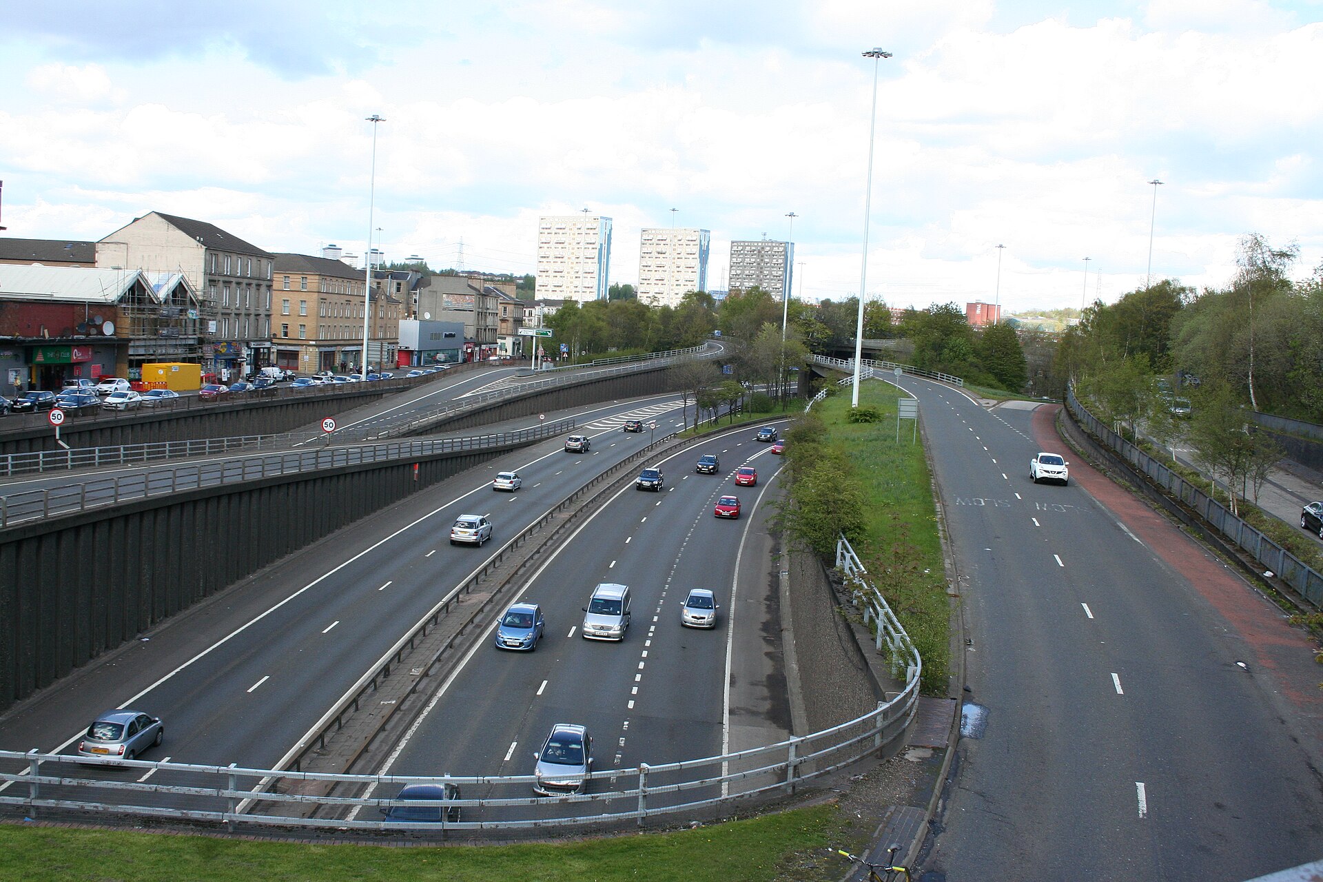
Then the motorway. The M8 wraps around the north and west of the city centre, sunk into a cutting through Charing Cross and Anderston in the 1960s and 70s, and it’s the real boundary between the centre and the West End. It also marks the northern edge of the Low Emission Zone, which runs south to the Clyde: non-compliant cars aren’t charged to enter, they’re banned outright, with a £60 penalty that doubles with each repeat.
Then the Subway. Opened in 1896, it’s the third-oldest underground railway in the world, and its 15 stations make a single loop that links the centre with the West End, Partick, Govan, Ibrox and the north edge of the Southside. What it doesn’t do is go east, or reach Shawlands, Strathbungo or Dennistoun. For those, the suburban trains from Central and Queen Street are your friend, and the buses fill in the rest.
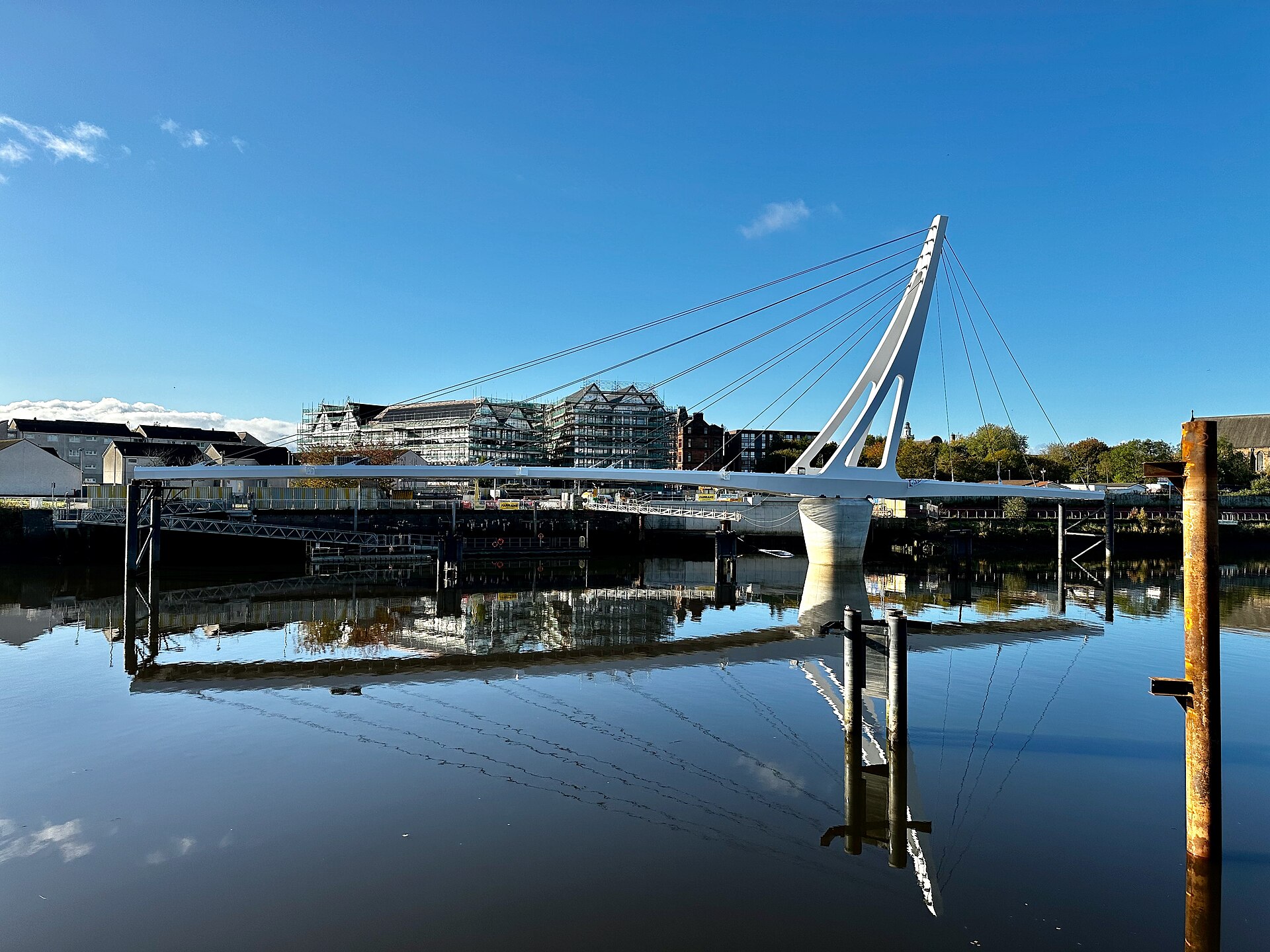
The newest link is the most symbolic. The Govan–Partick Bridge opened to walkers and cyclists in September 2024, joining Water Row in Govan to Pointhouse Quay beside the Riverside Museum and reconnecting two old burghs that a ferry used to link. It turns the Riverside Museum and the Govan Stones into a single afternoon.
The city centre: the grid and the Golden Z
Glasgow’s city centre is built on a grid laid out over Blythswood Hill in the early nineteenth century, and the first thing your legs will tell you is that the grid ignores the hill. Walk west along St Vincent Street or West George Street and you’ll feel it. The streets are lined with Victorian commercial palaces – banks, insurance offices and warehouses dressed up like Italian palazzos – and the best way to see them is to look up from the shopfronts.
The shopping runs along what locals call the Golden Z, or the Style Mile: down pedestrianised Buchanan Street, along Argyle Street and up Sauchiehall Street. Buchanan Street is the polished one, with Princes Square and the big flagship stores, and it’s where the buskers are best. Sauchiehall Street has had a rough decade. The 2018 fire that gutted the Glasgow School of Art’s Mackintosh Building also destroyed the O2 ABC music venue next door, and the street has been slow to recover, though part of it has been relaid with trees and wider pavements. Our shopping guide has the full picture.
At the centre of it all is George Square, with the City Chambers along its east side. It has just been through a major redevelopment and was due to reopen to the public at the end of August 2026, though work on some of the surrounding streets continues into 2027. Round the corner in Royal Exchange Square, the Gallery of Modern Art is free, and the Duke of Wellington statue outside usually has a traffic cone on its head – a Glasgow joke that has outlasted every attempt to stop it.
Who it suits: first-time visitors on a short trip, shoppers, and anyone who wants the bars and the big venues within walking distance. Who it doesn’t: anyone after a sense of neighbourhood life. The centre is a place you pass through more than one you settle into, and some streets go quiet once the offices and shops close.
For a fuller map of the centre – the grid, the Style Mile, the theatres, Central Station and the centre after dark – see our Glasgow city centre guide.
The Merchant City
East of George Square, the Merchant City is the old commercial quarter where the eighteenth-century tobacco lords built their mansions and warehouses. Their money came from the trade in tobacco grown by enslaved people in the Americas, and the street names – Virginia Street, Jamaica Street, Glassford Street, Ingram Street – carry that history whether the city wants them to or not. Today the restored buildings are full of restaurants, cocktail bars and boutiques, with the Tron Theatre on the Trongate and City Halls and the Old Fruitmarket on Candleriggs for concerts.
It’s at its best on a summer evening when the outdoor tables fill, and at its liveliest in late July and early August, when the Merchant City Festival takes over the streets. Our full guide to the Merchant City covers the history, the food and the festival, so we won’t repeat it here.
The West End
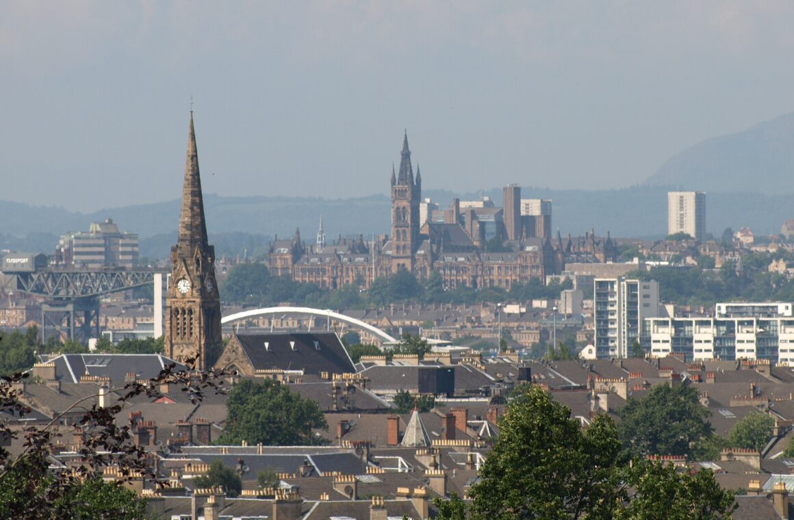
The West End is the Glasgow most visitors fall for. It was built in the nineteenth century as a suburb for the families getting rich from the city’s industry, and it still looks the part: honey-coloured sandstone terraces, crescents curving round private gardens, and the Gothic tower of the University of Glasgow on Gilmorehill. Hillhead was a burgh of its own until 1891, and the area still has the self-contained feel of a small town that happens to have a world-class museum in it.
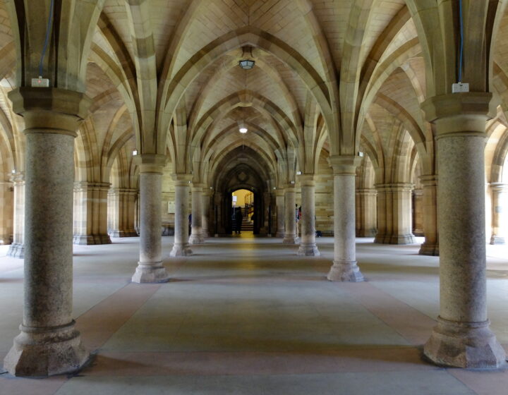
The big sights are all within a mile of each other. Kelvingrove Art Gallery and Museum is free and one of the most visited museums in the UK outside London; Kelvingrove Park runs down to the River Kelvin below it; the University of Glasgow has cloisters and quadrangles you can wander through for nothing; and the Botanic Gardens, with the Kibble Palace glasshouse, sit at the top of Byres Road. The Kelvin Walkway threads them together along the river.
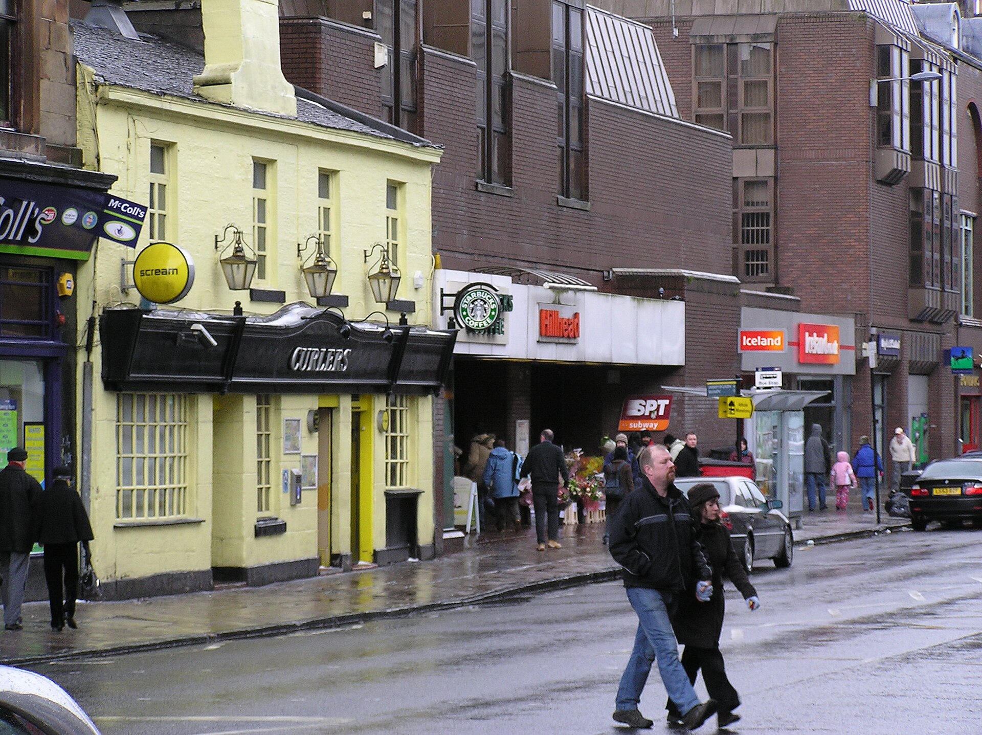
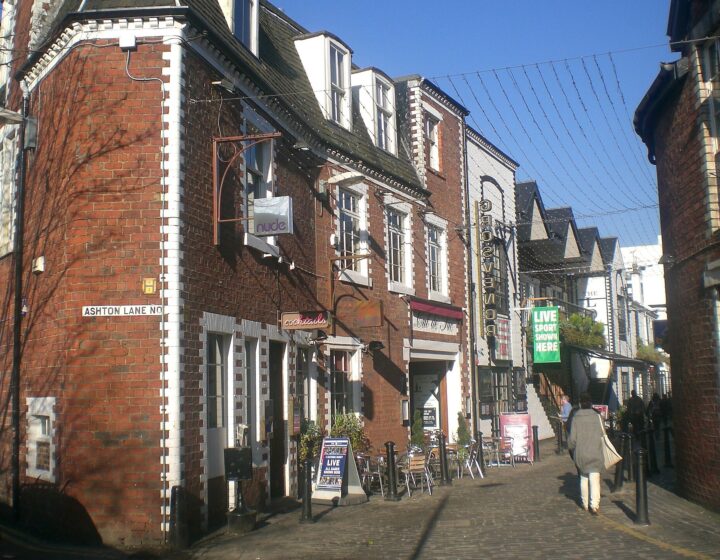
Byres Road is the spine, with cafés, delis, charity shops and pubs, and Ashton Lane, a cobbled lane of bars and restaurants strung with fairy lights, just off it. Òran Mór, a converted church at the top of Byres Road, runs A Play, A Pie and A Pint at lunchtime, which is exactly as Glaswegian as it sounds. For the full tour, see our guide to the West End and Byres Road.
Who it suits: museum-goers, families, slow travellers and anyone who likes a café with a newspaper. The honest catch: it knows how attractive it is, and prices on Byres Road reflect that. Ashton Lane on a Saturday night is loud and busy rather than charming, and in mid-September the students arrive and the pubs fill up. Hillhead and Kelvinbridge Subway stations put you right in it.
For the full picture – the sub-neighbourhoods from Hillhead to Park Circus, the museums, a one-day plan and the best times to go – see our Glasgow West End guide.
Finnieston
Finnieston used to be a district of docks, engine works and cranes. One of those cranes, the giant cantilever Finnieston Crane built to lift steam locomotives onto ships, still stands on the riverbank as the symbol of industrial Glasgow. Up the hill, the stretch of Argyle Street below Kelvingrove Park has become the most talked-about restaurant strip in the city, with seafood places, small-plates restaurants, cocktail bars and craft beer pubs almost shoulder to shoulder.
Down by the river, the old Queen’s Dock is now the Scottish Event Campus, home to the Armadillo and the OVO Hydro, Scotland’s largest venue. A little west, in Yorkhill, SWG3 runs gigs and club nights in a former galvanising works. Our guide to Finnieston and West End bars covers where to drink.
Who it suits: food lovers and gig-goers. It’s an evening neighbourhood more than a daytime one, and on a Hydro night the restaurants fill early, so book ahead. Exhibition Centre station is at the bottom of the hill, and Kelvinhall Subway is a short walk from the western end of the strip.
For the whole story – how the docks became a restaurant strip, the best of Argyle Street, Finnieston by day and how to do a gig night at the Hydro – see our Finnieston guide.
Partick and Hyndland
Partick is the West End’s less polished neighbour, and that’s its appeal. Dumbarton Road is a proper working main street – charity shops, bakers, cafés, takeaways and old men’s pubs – and it costs a good deal less to eat here than on Byres Road, ten minutes’ walk away. Partick was a burgh until 1912, and its station is now one of the city’s main interchanges, where the Subway, the suburban trains and the buses meet.
Down at the river, the Riverside Museum sits at Pointhouse Quay, free, with the tall ship Glenlee moored outside and the new bridge to Govan beside it. Uphill, Hyndland is a different world: a conservation area of red sandstone tenements with deep bay windows and stained glass, and quiet streets that feel a long way from the traffic on Dumbarton Road. Belle and Sebastian fans will know Hyndland Parish Church, where the band rehearsed in the 1990s; our guide to Glasgow’s bands and music landmarks has the story.
Who it suits: travellers on a budget, anyone who prefers a local street to a postcard one, and families heading for the Riverside Museum. Partick won’t win any beauty contests, but it’s real.
For Dumbarton Road’s pubs, the Kelvin Hall film archive, the walk across the bridge to the Govan Stones and Hyndland’s tenements and music history, see our Partick and Hyndland guide.
The Southside
Southsiders will tell you, unprompted, that the Southside is the better half of the city. They have a point. South of the river you’ll find the city’s biggest parks, some of its best independent cafés and restaurants, and its most diverse streets, spread across a string of neighbourhoods, several of which were separate burghs until 1891 or 1912.
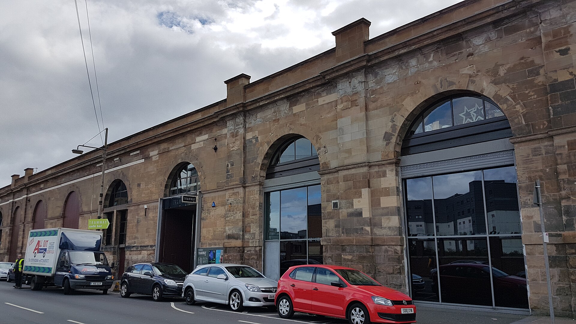
- Pollokshields: wide streets of Victorian villas, and home to much of Glasgow’s South Asian community, which shows in the shops and restaurants. Tramway, an arts centre in a former tram depot on Albert Drive, is two minutes from Pollokshields East station, with the Hidden Gardens beside it.
- Strathbungo: a small grid of streets off Pollokshaws Road, best known for Moray Place, a terrace designed by Alexander “Greek” Thomson, who lived at number 1.
- Shawlands: the Southside’s high street, along Kilmarnock Road and Pollokshaws Road, with cafés, bars and restaurants, and the Southside Fringe arts festival every May. See our Shawlands and Strathbungo guide.
- Queen’s Park: a Victorian park on a hill with one of the best views over the city from its flagpole. The Battle of Langside, where Mary, Queen of Scots lost her last battle in 1568, was fought just to the south. See our Queen’s Park guide.
- Govanhill and Battlefield: Govanhill is one of the most diverse neighbourhoods in Scotland, with food from half the world on Allison Street and Victoria Road.
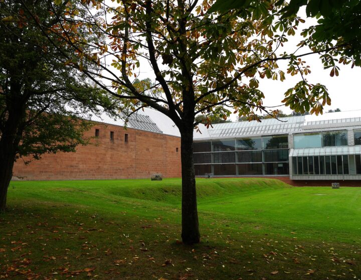
- Pollok Country Park: 360 acres of woodland and parkland, Highland cattle, Pollok House and the Burrell Collection, which reopened in 2022 after a major refurbishment. Pollokshaws West station is the closest. See our Pollok Country Park guide.
Mount Florida, further south, is Hampden territory, home of the Scotland team and the Scottish Football Museum, and Linn Park, with its river gorge and woods, is further out again. Getting around the Southside means trains more than the Subway: the Cathcart Circle line from Central serves Pollokshields, Crosshill, Queen’s Park and Mount Florida, and Shawlands has its own station. Shields Road on the Subway is handy for Pollokshields.
Who it suits: food lovers, families, park people and anyone who wants to see how Glaswegians actually live. The catch: the sights are spread out, so plan your days by area rather than trying to zigzag.
For the full picture – every Southside neighbourhood, what’s currently closed, a one-day plan from the Burrell to Tramway and how the trains work – see our Glasgow Southside guide.
The East End
The East End is where Glasgow began. On the hill at the top of High Street stand Glasgow Cathedral, the only medieval cathedral on the Scottish mainland to survive the Reformation with its roof intact, and the Necropolis, the Victorian city of the dead on the slope behind it. Across the road, Provand’s Lordship, built in 1471, is the oldest house in the city.
Downhill, Glasgow Cross and the Trongate mark the old heart of the medieval town. East of there is Calton, home to the Barras, the weekend market that has been trading since the 1920s, and the Barrowland Ballroom, with its neon sign and sprung floor, the most loved gig venue in the city. South of the Barras, Glasgow Green is the city’s oldest park; the People’s Palace and its Winter Gardens are closed for refurbishment, with reopening expected around 2027.
Further out, Dennistoun is a Victorian tenement neighbourhood along Duke Street and Alexandra Parade that has filled up with independent cafés, bakeries and bars in recent years, with the Tennent’s Wellpark Brewery and the Drygate brewery at its western end. Parkhead is Celtic Park country, and part of Dalmarnock was rebuilt as the athletes’ village for the 2014 Commonwealth Games.
Who it suits: history lovers, music fans, football fans and market browsers. The honest note: the East End has some of the poorest streets in Scotland alongside its regeneration, and parts of it look it. Don’t expect polish between the sights. Do expect some of the friendliest pubs in the city.
Govan and Ibrox
Govan is older than Glasgow, at least as a place that mattered. In the early Middle Ages it was a royal and religious centre of the kingdom of Strathclyde, and the churchyard of Govan Old Church has been a burial ground for around 1,500 years. Inside the church are the Govan Stones: a carved stone sarcophagus that may once have held the relics of St Constantine, a collection of cross-slabs and crosses, and five Viking-era hogback stones. Entry is free and the church is about 150 metres from Govan Subway station; it opens daily in the warmer months, roughly April to October, so check the hours before you go. Excavations in the churchyard by University of Glasgow archaeologists were still turning up new carved stones in 2026.
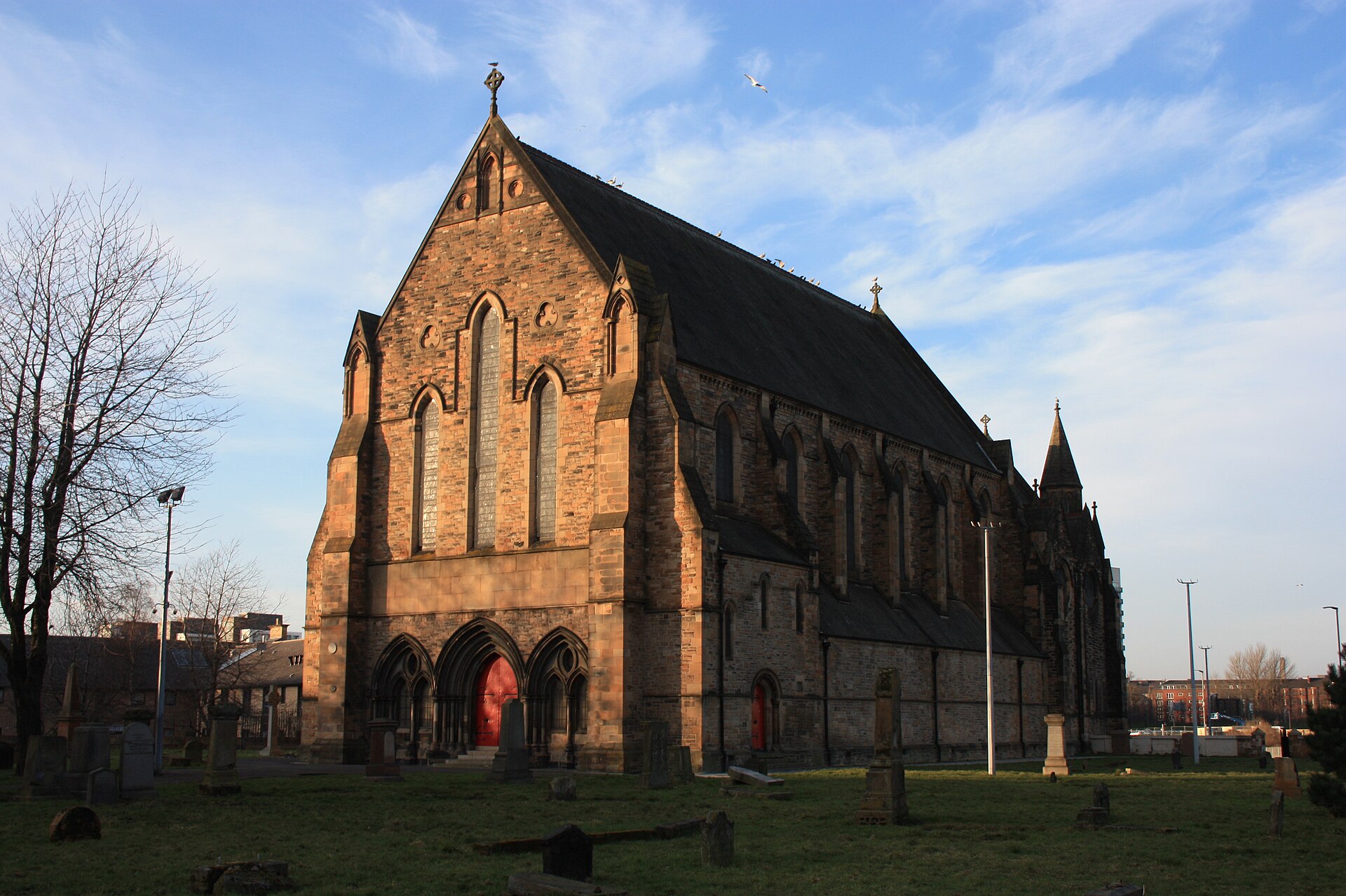
The later story is ships. Govan was one of the great shipbuilding burghs of the Clyde, it was a burgh until 1912, and the yard on its waterfront still builds warships today. The main road isn’t pretty, and the area has had hard decades, but the river frontage, the old church and the new bridge across to Partick make it worth the trip. Just to the south, Ibrox, home of Rangers, has its own Subway station and runs stadium tours on non-match days.
The Gorbals, Laurieston and Tradeston
Across the river from the city centre, the Gorbals was once the most notorious slum in Britain, then the site of some of its most ambitious and ill-fated tower blocks. Basil Spence’s Queen Elizabeth Square towers came down in 1993, and the area has been rebuilt again since, with new streets of flats in the Gorbals and Laurieston. The reason most visitors cross the river is the Citizens Theatre on Gorbals Street, housed in a Victorian playhouse that opened in 1878 and back in business since August 2025 after seven years of redevelopment. Our guide to Glasgow’s theatres has the details.
West of the Gorbals, Tradeston is joined to the Broomielaw by the Tradeston Bridge, which everyone calls the Squiggly Bridge. These are mostly residential and office districts rather than places to linger, but they’re a short walk from Central Station and an easy way to reach the south bank’s riverside path.
Beyond the inner neighbourhoods
Glasgow keeps going well beyond these areas, and most visitors never see the outer neighbourhoods. A few are worth knowing about. North of the M8, the Forth and Clyde Canal runs through Port Dundas and Maryhill, with a towpath that makes a quiet walk or bike ride and a flight of locks at Maryhill. Out west, Scotstoun is home to Glasgow Warriors rugby. And if you want to see the parks and walks that connect the neighbourhoods, our walking routes guide links several of them together.
Which Glasgow neighbourhood suits you?
- A first visit of two or three days: base yourself in or near the city centre and the Merchant City, spend a day in the West End, and add the Cathedral and Necropolis in the East End.
- Museums and parks: the West End, with Kelvingrove, the Hunterian at the university and the Botanic Gardens, then the Southside for the Burrell and Pollok Country Park.
- Food: Finnieston for dinner, Shawlands and Strathbungo for brunch and neighbourhood restaurants, Pollokshields and Govanhill for South Asian cooking. Our Glasgow food guide has the best of each.
- Live music: Calton for the Barrowland, Finnieston and Yorkhill for the Hydro and SWG3, and the city centre for King Tut’s and the small basement venues.
- Families: the West End for Kelvingrove and the playparks, Partick for the Riverside Museum, and the Southside for the big parks.
- Football: Parkhead for Celtic, Ibrox for Rangers and Mount Florida for Hampden.
- A tight budget: Partick, Govanhill and Dennistoun for cheap eats and honest pubs.
For the full list of sights by theme, see our guide to things to do in Glasgow.
Two neighbourhood days that join the dots
West End to Govan, across the river
Start at Kelvingrove when it opens, then walk down through Kelvingrove Park and follow the Kelvin to the Riverside Museum. Cross the Govan–Partick Bridge to Govan Old Church for the Govan Stones (in season), then take the Subway from Govan a few stops round the loop to Shields Road and walk to Tramway and the Hidden Gardens in Pollokshields. Ride back into town for dinner in Finnieston or the Merchant City. That’s a great museum, a riverside walk, carved stones a thousand years old and two old burghs in a day, and the only ticket you need is the Subway’s £3.40 daily cap.
The old city and the East End
Begin at Glasgow Cross and walk up High Street to the Cathedral, Provand’s Lordship and the Necropolis. From there, head out along Duke Street to Dennistoun for lunch in one of its cafés, then come back west along the Gallowgate to the Barras if it’s a weekend. Glasgow Green and the river are a few minutes south of the market, and in the evening there may well be a gig at the Barrowland. Allow a full day and wear comfortable shoes: it’s all on foot, and the first part is uphill.
Getting between the neighbourhoods
The Subway is the quickest way between the centre, the West End, Partick and Govan, and with contactless you’ll never pay more than £3.40 in a day. For the Southside and the East End, the suburban trains are faster than the buses: our ScotRail guide explains the lines. Buses go everywhere the trains don’t, and our bus guide covers tickets and the main routes.
Walking is underrated. The city centre to Kelvingrove is about half an hour, the Merchant City to the Cathedral is a 15-minute walk uphill, and the walk along the Clyde from Glasgow Green to the Riverside Museum takes in half the city’s history. If you’re driving, park outside the Low Emission Zone and use a park-and-ride site. Our guide to getting around Glasgow has everything else.
A word on safety
Glasgow’s old hard-man reputation has outlived the reality by some distance. The neighbourhoods in this guide are fine to explore by day and, with the usual big-city sense, at night. As in any city, keep an eye on your phone in busy bars, stick to lit main roads late at night, and don’t judge an area by the state of its main street. Our Glasgow safety tips cover the practicalities.
Glasgow neighbourhoods: frequently asked questions
What are the best areas of Glasgow for tourists?
The city centre and the Merchant City for convenience, the West End for museums, parks and cafés, and Finnieston for food. With more time, the Southside and the East End show you a side of the city most visitors miss.
What is the coolest neighbourhood in Glasgow?
It depends who you ask. Finnieston has the buzz and the restaurants; the Southside, especially Shawlands and Strathbungo, and Dennistoun in the East End are where a lot of younger Glaswegians actually live, drink and eat.
Is the West End or the Southside better to visit?
The West End is better for a first visit: the big sights are close together and on the Subway. The Southside rewards a second visit, or a longer stay, with bigger parks, the Burrell and a more local feel.
What is the difference between the city centre and the Merchant City?
The Merchant City is the eastern part of the centre, the old commercial quarter of the tobacco lords, now mostly restaurants, bars and flats. The rest of the city centre is the Victorian grid of shops and offices around Buchanan Street and Sauchiehall Street.
Which Glasgow neighbourhoods are on the Subway?
The city centre, the West End (Hillhead, Kelvinbridge, Kelvinhall), Partick, Govan, Ibrox and the northern edge of the Southside (Shields Road, West Street, Bridge Street). It doesn’t serve the East End, Shawlands or Dennistoun; use the suburban trains.
Is the East End of Glasgow worth visiting?
Yes. The Cathedral, the Necropolis and Provand’s Lordship are the oldest things in the city, the Barras and the Barrowland are pure Glasgow, and Dennistoun is one of the best neighbourhoods for cafés and bars. Just don’t expect it to be polished.
Related Glasgow Guides
- Where to stay in Glasgow
- Things to do in Glasgow
- Glasgow food guide
- The Merchant City
- The West End and Byres Road
- Finnieston and West End bars
- Queen’s Park
- Getting around Glasgow
Photo Credits
Glasgow from Queen’s Park: View of Glasgow from Queens Park by John Lindie, CC BY 2.0, via Wikimedia Commons.
The Govan–Partick Bridge from Pointhouse Quay: 231022e Govan-Partick Bridge, from Pointhouse Quay by dave souza, CC BY-SA 4.0, via Wikimedia Commons.
Govan Old Parish Church: Govan Old Parish Church by Stephencdickson, CC BY-SA 4.0, via Wikimedia Commons.