Glasgow is one of the most navigable cities in the United Kingdom for visitors. Compact enough to explore much of the centre on foot, yet equipped with an underground subway system, an extensive bus network, suburban trains, and excellent cycling infrastructure, getting around Glasgow is straightforward, affordable, and — in the case of the world’s third-oldest subway — genuinely enjoyable.
Whether you’re arriving by plane, planning to explore the city’s museums and restaurants, or using Glasgow as a base for day trips into the Scottish Highlands, this complete transport guide covers everything you need to know. From airport transfers and subway tips to bus routes, train connections, taxi advice, and the best walking routes through the city centre, we’ve distilled the practical details that will save you time, money, and confusion.
Use this guide alongside our recommendations for things to do in Glasgow, where to stay, and the best day trips from Glasgow to plan a seamless trip.
Getting Around Glasgow: Table of Contents
- Getting to Glasgow: Airports & Arrival
- Glasgow Subway: The Clockwork Orange
- Buses in Glasgow
- Trains: Glasgow Central & Queen Street
- Taxis & Rideshare
- Cycling in Glasgow
- Walking Glasgow: The Best Way to See the City
- Driving & Car Hire
- Multi-Modal Tickets & Passes
- Transport to Key Attractions
- Accessibility Guide
- Glasgow to Edinburgh & Beyond
- Practical Tips for Getting Around
- Getting Around Glasgow: Frequently Asked Questions
Getting Around Glasgow: Getting to Glasgow: Airports & Arrival
Glasgow is served by two airports, excellent rail connections from across the UK, and long-distance coach services. Here’s how to get into the city from each arrival point.
Glasgow Airport (GLA)
Glasgow Airport is the city’s main international gateway, located eight miles west of the centre in Paisley. It handles flights from across Europe, North America, and the Middle East, with airlines including British Airways, easyJet, Ryanair, Jet2, Loganair, and seasonal transatlantic services.
The Glasgow Airport Express (First Bus service 500) is the most popular transfer option. Buses depart every 10 minutes, 24 hours a day, running to Buchanan Bus Station via the city centre. The journey takes 25–35 minutes depending on traffic, and a single adult fare costs £7.50 (child £4). Contactless payment is accepted on board. The bus stops at several city centre locations, making it convenient for most hotels.
A taxi from the airport to the city centre takes around 20 minutes and costs approximately £16–20. Taxis are available 24 hours from the rank directly outside arrivals — no advance booking is needed. Uber also operates in Glasgow and can be a similar price to traditional taxis.
There is no direct rail link to Glasgow Airport (a planned Glasgow Airport Rail Link was cancelled in 2009). The nearest station is Paisley Gilmour Street, about two miles away, reachable by the McGill’s 757 bus or a short taxi ride. From Paisley, trains to Glasgow Central take just 10 minutes.

Glasgow Prestwick Airport (PIK)
Prestwick Airport, 32 miles south of Glasgow, is primarily used by Ryanair. It has the advantage of its own dedicated railway station — connected to the terminal by a covered walkway. Trains run to Glasgow Central every 30 minutes, taking about 45 minutes, with fares from around £8 return. The Stagecoach X77 express bus also connects Prestwick to Glasgow Buchanan Bus Station.
By Train
Glasgow is well connected by rail from across the UK. LNER and Avanti West Coast services run from London (4.5 hours from King’s Cross or Euston), while TransPennine Express connects Manchester, Leeds, and other northern English cities. CrossCountry services link Bristol, Birmingham, and the southwest. ScotRail operates frequent services from Edinburgh (50 minutes), Stirling (30 minutes), and other Scottish cities. Glasgow has two main railway stations — Central and Queen Street — both in the heart of the city centre, about a 10-minute walk from each other.
By Bus
National Express, Megabus, and FlixBus operate long-distance coaches to Glasgow’s Buchanan Bus Station from London (approximately 8–9 hours), Manchester, Birmingham, and other UK cities. Fares can be extremely competitive — advance Megabus tickets from London start from as little as £5 — making this the budget option for reaching Glasgow. Scottish Citylink covers routes within Scotland, including Edinburgh (75 minutes), Stirling, and the Highlands.
Getting Around Glasgow: Glasgow Subway: The Clockwork Orange
Glasgow’s subway is one of the city’s most charming features and a remarkably efficient way to travel. Opened in 1896, it is the third-oldest underground railway in the world — after London and Budapest — and the only subway system in Scotland. Locals affectionately call it the ‘Clockwork Orange’ after the colour of its original trains, though the newest rolling stock is a sleeker design.
How It Works
The system is wonderfully simple: a single circular loop with 15 stations, running in two directions — the Outer Circle (clockwise) and the Inner Circle (anticlockwise). There are no branch lines, no changes, and no confusing zone maps. A complete circuit takes about 24 minutes. The subway connects the city centre (Buchanan Street, St Enoch), the West End (Hillhead for the university area, Kelvinbridge), the South Side (Ibrox for Rangers FC, Cessnock), and key interchange points (Partick for trains to the Riverside Museum and West Highland Line).
Fares & Payment
As of 2026, a single adult journey costs £1.80 using a Subway Smartcard (available from any station) or contactless bank card. An all-day pass costs £3.40 — outstanding value if you’re making multiple trips. Children under 5 travel free, and children aged 5–15 get reduced fares. Contactless payment (including Apple Pay and Google Pay) is accepted at all stations, so you don’t necessarily need a Smartcard.
Operating Hours
The subway runs Monday to Saturday from approximately 6:30am to 11:30pm, and Sundays from 10am to 6pm (reduced service). Trains run every 4–8 minutes during peak hours. Note the relatively early Sunday closing time — plan accordingly if you’re heading home from Sunday dinner in the West End.
Key Stations for Visitors
Buchanan Street — city centre shopping, Buchanan Galleries, Royal Concert Hall. Hillhead — Byres Road restaurants, University of Glasgow, Kelvingrove Museum. St Enoch — St Enoch Centre, Argyle Street, close to Merchant City nightlife. Partick — interchange for trains to the Riverside Museum and West Highland Line. Kelvinhall — Kelvingrove Park western entrance. Ibrox — Ibrox Stadium (Rangers FC).
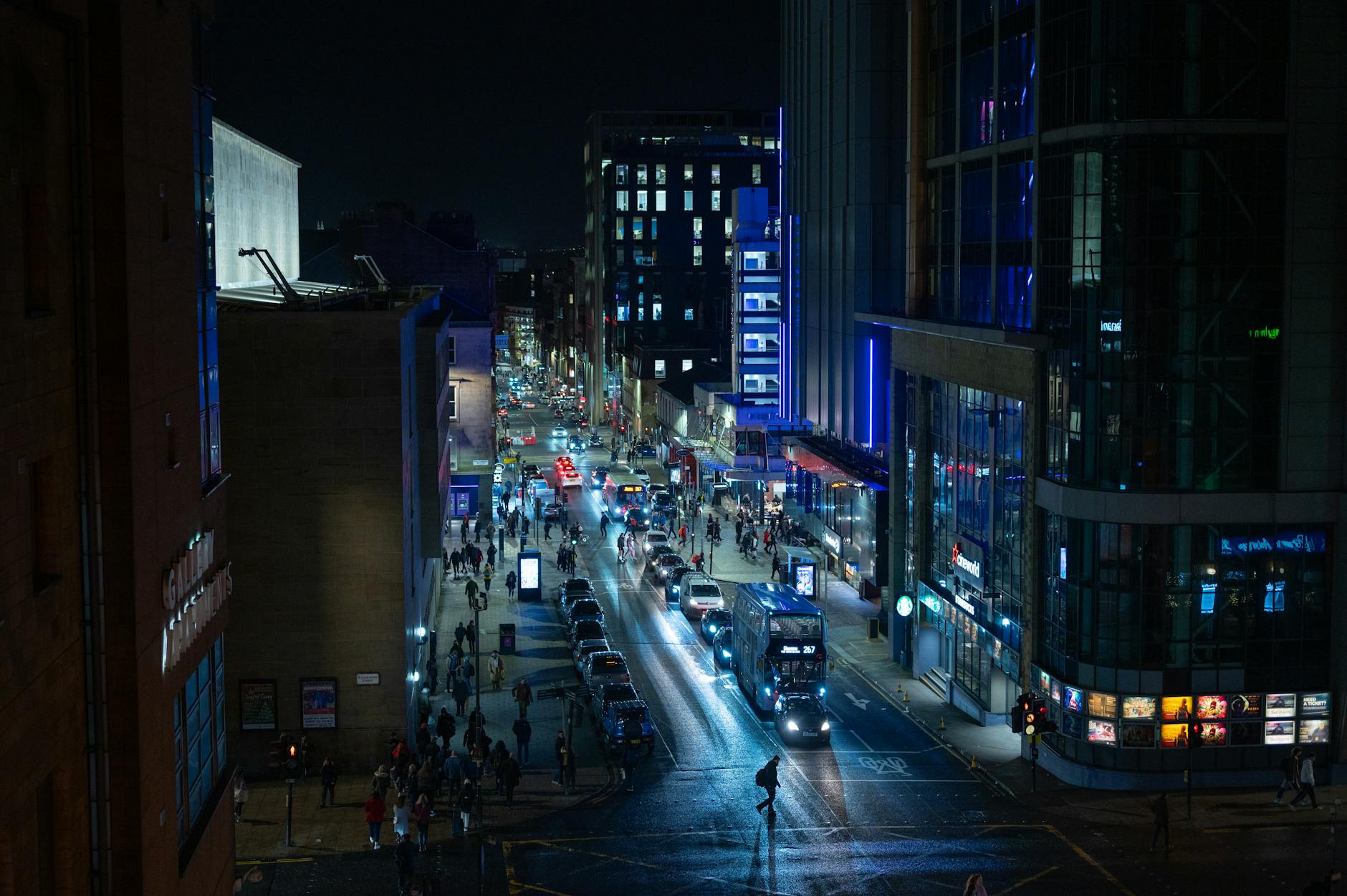
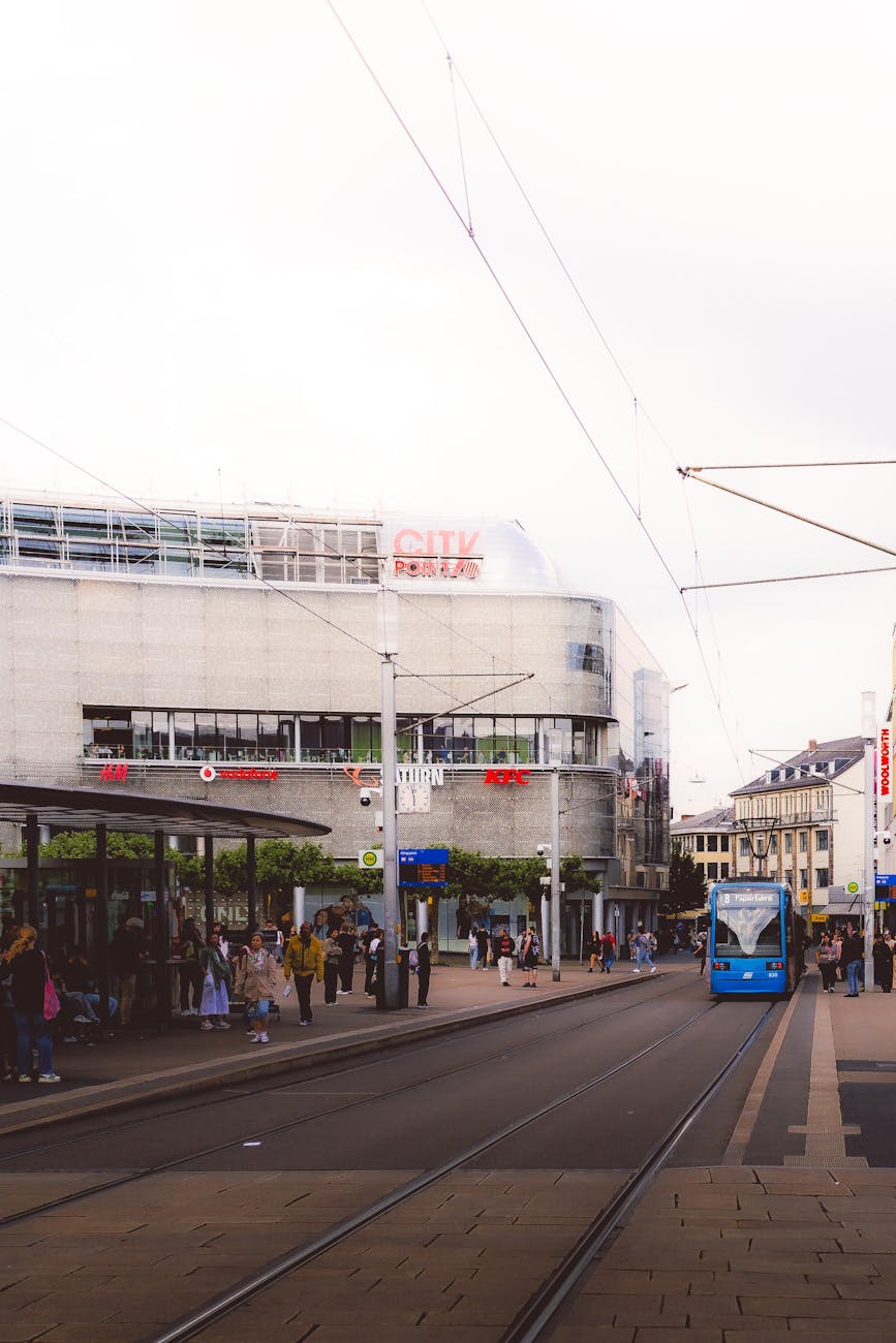
Buses in Glasgow
Glasgow’s bus network is the most extensive public transport option in the city, reaching areas the subway and trains don’t cover. First Glasgow is the largest operator, running the majority of city services, with McGill’s and Stagecoach covering additional routes.
Paying for Bus Travel
All First Glasgow buses accept contactless payment (bank cards, Apple Pay, Google Pay), making travel simple for visitors. The Tap On, Tap Off system means your fares are automatically capped at the day ticket price — no matter how many journeys you make, you’ll never pay more than the daily maximum. Single fares are around £2.50 for adults. You can also buy tickets through the First Bus app or pay with exact cash (no change given).
Useful Routes for Visitors
The Glasgow Airport Express (500) runs every 10 minutes between the airport and city centre. For visitors staying in the West End, the 8 and 8A services run from the city centre via Great Western Road to the University area. The 75 service connects the city centre with the Burrell Collection in Pollok Park. The 38 and 38A reach the Glasgow Science Centre. The 240 and 267 serve routes to Loch Lomond via Balloch for day trips.
Night Buses
Night bus services are limited compared to daytime frequencies, but several routes operate into the early hours on Friday and Saturday nights. The N1 and N2 services cover key corridors including the city centre, West End, and South Side. If you’re enjoying Glasgow’s famous nightlife, check the First Bus app for late-night departure times or keep the taxi numbers saved in your phone.
Trains: Glasgow Central & Queen Street
Glasgow has two main railway stations, both centrally located and within a 10-minute walk of each other. Understanding which station you need is the key to smooth rail travel in and around the city.
Glasgow Central
Glasgow Central is Scotland’s busiest station and the city’s main terminus for services to the south and west. From the high-level platforms, trains depart for London (Avanti West Coast), Manchester, Birmingham, Edinburgh (via Shotts), Ayrshire, Arran ferry connections at Ardrossan, Paisley, and the Clyde coast. The low-level platforms serve the Argyle Line suburban network, connecting the South Side, Partick (for the Riverside Museum), and the West End. The station itself is a magnificent Victorian building with a stunning glass roof and excellent food and shopping options.
Glasgow Queen Street
Queen Street handles services to the north and east. This is your station for Edinburgh (via Falkirk, the faster route — 50 minutes), Stirling (30 minutes), the Highlands (Fort William, Oban, Inverness), Dundee, Aberdeen, and the suburban North Clyde Line to Milngavie, Balloch (for Loch Lomond), and Helensburgh. The station underwent a major refurbishment completed in 2021 and now has modern facilities.
Getting Between Stations
The two stations are about a 10-minute walk apart along George Square and the city centre’s pedestrianised shopping streets. A free shuttle bus operates between them, which is particularly useful with heavy luggage or in bad weather. The Buchanan Street subway station sits between the two, and some low-level services at both stations connect via underground platforms.
Tickets & Tips
ScotRail is Scotland’s national rail operator. Buy tickets through the ScotRail app, at station machines, or online through Trainline. Advance tickets offer the best value — an advance single from Glasgow to Edinburgh can cost as little as £6 compared to £16 for a walk-up ticket. Off-peak returns are available after 9:15am on weekdays and all day at weekends. ScotRail abolished peak fares in September 2025, so peak-time travel is now the same price as off-peak on most routes.
Taxis & Rideshare
Glasgow’s iconic black cabs are plentiful and can be hailed on the street throughout the city centre. Glasgow Taxis is the largest operator, with over 800 licensed vehicles. You can also phone for a cab on 0141 429 7070. All licensed taxis are metered and accept contactless payment.
Typical city centre fares are £5–8 for short trips and £10–15 to reach areas like the West End or South Side from the centre. An airport taxi costs around £16–20. Uber operates in Glasgow and is generally price-competitive with traditional taxis, sometimes cheaper for longer journeys. Both taxi and Uber availability can be limited during peak nightlife hours on Friday and Saturday evenings — be prepared to wait or pre-book.

Cycling in Glasgow
Glasgow has invested significantly in cycling infrastructure in recent years, with dedicated cycle lanes on many major routes and an expanding network of off-road paths. For visitors, cycling is an excellent way to explore the city’s parks, riverside paths, and neighbourhoods.
Bike Hire
Glasgow’s public bike hire scheme is now operated by VOI, which replaced the previous Nextbike service in late 2025. All bikes in the scheme are e-bikes, available from docking stations across the city centre, West End, and South Side. You can hire a bike through the VOI app — rates vary but typically start from £1 to unlock plus a per-minute charge. The electric assistance makes Glasgow’s hills much more manageable for visitors.
Best Cycling Routes
The Clyde Walkway/Cycle Path follows the River Clyde from the city centre through Glasgow Green and out towards Cambuslang — a flat, traffic-free route ideal for families. The Kelvin Walkway runs from Kelvingrove Park through the Botanic Gardens to Maryhill — a beautiful green corridor along the River Kelvin. For a longer ride, the path to Loch Lomond via the West Highland Way starts from Milngavie, accessible by train from the city centre.

Walking Glasgow: The Best Way to See the City
Glasgow’s city centre is compact enough that walking is often the fastest and most enjoyable way to get around. The grid-pattern streets of the Merchant City and commercial centre are easy to navigate, and the city’s wealth of Victorian and Art Nouveau architecture rewards those who look up as they walk. Many of Glasgow’s key attractions — from GoMA to the Lighthouse to the Merchant City restaurants — are within a 15-minute walk of George Square.
Key Walking Distances
George Square to Kelvingrove Museum: 25 minutes through the commercial centre and along Sauchiehall Street. George Square to Glasgow Cathedral: 10 minutes east along the medieval High Street. Buchanan Street to the Riverside Museum: 35 minutes via the Clydeside Expressway path (or 10 minutes by subway to Partick). City centre to the West End (Byres Road): 20–25 minutes via Sauchiehall Street and Kelvingrove Park.
Self-Guided Walking Routes
The City Centre Mural Trail is one of Glasgow’s most popular walking routes, leading you past dozens of large-scale street art murals painted on building walls throughout the city centre and Merchant City. Maps are available from the tourist information centre or downloadable from the Visit Glasgow website. The Mackintosh Trail connects the key sites associated with Charles Rennie Mackintosh, from the Lighthouse to the Willow Tea Rooms. The Glasgow Necropolis, behind Glasgow Cathedral, offers a dramatic hilltop walk through a Victorian cemetery with panoramic city views.
Driving & Car Hire
You don’t need a car to explore Glasgow itself — public transport, walking, and cycling cover the city comprehensively. However, a hire car is invaluable for day trips to Glencoe, rural Ayrshire, and other destinations beyond the public transport for getting around Glasgow.
Car Hire
Major hire companies (Enterprise, Hertz, Avis, Europcar, Sixt) operate from Glasgow Airport and city centre locations. Book in advance for the best rates, especially in summer. An economy car typically costs £30–50 per day. You’ll need a valid driving licence and most companies require drivers to be at least 21 (some 25 for premium vehicles). Automatic cars are available but less common than manuals — specify when booking.
Driving Tips
Glasgow drives on the left. The city centre has a one-way system that can confuse newcomers — sat nav is recommended. Parking in the centre is metered (typically £2–3 per hour) with several multi-storey car parks available. The M8 motorway runs directly through the city, connecting to Edinburgh (M8 east), Stirling and the Highlands (M80 north), and the Ayrshire coast (M77 south). Glasgow does not currently have a congestion charge or Low Emission Zone charge for Euro 4/6 compliant vehicles.
For day trips, the A82 to Loch Lomond and the Highlands is one of Scotland’s most scenic drives but can be busy in summer. Many Highland roads are single-track with passing places — yield to oncoming traffic and pull into passing places on your left. Petrol stations become less frequent in rural areas, so fill up before heading into the Highlands.
Parking in Glasgow
On-street parking in the city centre is controlled by meters, typically costing £2–3 per hour with a maximum stay of two hours during the day. Multi-storey car parks offer better value for longer stays — the NCP Buchanan Galleries, Mitchell Street, and Waterloo Street car parks all charge around £10–15 for a full day. Free on-street parking is available in some residential areas of the West End and South Side, but check signage carefully for restrictions. Most attractions outside the city centre — including the Burrell Collection in Pollok Park and the Riverside Museum — offer free parking. On Sundays, many city centre meters are free, making it the easiest day to drive into town.
Glasgow’s Low Emission Zone (LEZ) came into full effect in June 2023 and covers the city centre bounded by the M8 motorway. Most modern petrol cars (Euro 4 or later, broadly 2006 onwards) and diesel cars (Euro 6, broadly 2015 onwards) are compliant. You can check your vehicle’s compliance using the Scottish Government’s LEZ checker tool before driving into the zone. Non-compliant vehicles face a penalty charge
Multi-Modal Tickets & Passes
If you’re planning to use multiple forms of transport during your stay, several passes can save money and simplify travel.
SPT ZoneCard
The ZoneCard is the most comprehensive multi-modal ticket in the west of Scotland, covering ScotRail trains, Glasgow Subway, and most bus operators within your chosen zones. Available as daily, weekly, or monthly passes, it’s particularly good value for longer stays. Purchase online at zonecard.co.uk or at Payzone outlets. Following the abolition of ScotRail peak fares in 2025, most ZoneCard prices were reduced.
Subway Day Pass
At just £3.40 for unlimited all-day subway travel, this is one of the best-value transport deals in the UK. If you’re making more than two subway journeys in a day, the day pass pays for itself. Available on your Subway Smartcard or via contactless payment (fares are automatically capped).
ScotRail Passes
The Spirit of Scotland Pass offers unlimited ScotRail travel for 4 or 8 days and also covers certain ferry routes — excellent value if you’re combining Glasgow with day trips to Edinburgh, Stirling, and beyond. The Highland Rover pass covers 4 days of travel within 8 days on ScotRail routes in the Highlands, including the Fort William and Oban lines.
Transport to Key Attractions
Here’s a quick reference for reaching Glasgow’s most popular visitor attractions from the city centre:
Kelvingrove Museum: Subway to Kelvinhall or Kelvinbridge (5 mins), or bus 2/3 from Hope Street (15 mins). Riverside Museum: Subway to Partick then 10-minute walk, or bus 100 from city centre. Burrell Collection: Bus 3, 4, 37, 57 from Union Street to Pollokshaws Road (20 mins). Gallery of Modern Art: Central location, 5-minute walk from Buchanan Street subway. Glasgow Science Centre: Bus 38/38A from Union Street (15 mins), or walk from Cessnock subway (15 mins). Glasgow Cathedral & Necropolis: 10-minute walk east from George Square. Hampden Park (Scottish Football Museum): Train from Glasgow Central to Mount Florida (10 mins).
Accessibility Guide
Glasgow’s public transport has improved significantly in accessibility, though some older infrastructure still presents challenges. All First Glasgow buses are low-floor and wheelchair accessible, with designated wheelchair spaces and audio/visual announcements on newer vehicles. The Glasgow Subway is being modernised with new accessible trains and station upgrades, but not all stations currently have step-free access — Buchanan Street, St Enoch, Hillhead, and Partick are among those with lift access.
ScotRail trains are wheelchair accessible on most routes, with ramps available at staffed stations. Glasgow Central and Queen Street both have step-free access to platform level via lifts. The Passenger Assist service allows you to pre-book assistance for train journeys. Glasgow Taxis have a fleet of wheelchair-accessible vehicles available on request. For detailed accessibility information, the Euan’s Guide website provides user-reviewed access ratings for venues and transport across Glasgow.
Glasgow to Edinburgh & Beyond
The Glasgow–Edinburgh corridor is one of the busiest in Scotland, and you have several options for making the 47-mile journey between cities.
By Train
The fastest and most popular option. ScotRail runs services from Glasgow Queen Street to Edinburgh Waverley every 15–20 minutes via Falkirk High, taking approximately 50 minutes. LNER services also run this route. An off-peak return costs around £15–20, while advance singles can be as low as £6. Since ScotRail abolished peak fares in 2025, there’s no premium for travelling during rush hour.
By Bus
Scottish Citylink and Megabus run frequent services from Buchanan Bus Station to Edinburgh Bus Station, taking approximately 75 minutes. Fares are typically £8–12 return — cheaper than the train but slower. Buses run every 15–30 minutes throughout the day.
By Car
The M8 motorway connects Glasgow to Edinburgh in about an hour, though journey times vary significantly with traffic. Parking in Edinburgh city centre is expensive and limited, so the train is generally the better option unless you need a car for onward travel.
Practical Tips for Getting Around
Contactless is King
Glasgow has embraced contactless payment across its transport network. Your bank card, Apple Pay, or Google Pay will work on buses, the subway, and ScotRail trains. There’s very little reason to carry cash for transport.
Download These Apps
First Bus App — live bus times, route planning, and mobile tickets. ScotRail App — train tickets, live departures, and journey planning. VOI App — bike hire across the city. Uber — rideshare alternative to taxis. Citymapper — excellent multi-modal journey planner that covers Glasgow.
Glasgow’s Grid System
Glasgow’s city centre follows a grid pattern, making navigation straightforward. The main shopping streets (Buchanan Street, Sauchiehall Street, Argyle Street) form a ‘Golden Z’ through the centre. George Square is the civic heart and a useful landmark for orientation. Remember that the city slopes uphill from the River Clyde towards the cathedral — heading ‘up’ generally means north.
Safety
Glasgow’s public transport is generally safe, including at night. The city centre and West End are well-lit and busy. Standard precautions apply: keep valuables secure, be aware of your surroundings on late-night buses, and stick to well-lit routes when walking after dark. Glasgow has a reputation that predates its modern reality — today it’s a welcoming, friendly city where visitors are warmly received.
Frequently Asked Questions
Is Glasgow easy to get around?
Glasgow is very easy to get around. The city centre is compact and walkable, the subway is simple (one circular loop, 15 stations), buses are frequent, and contactless payment works everywhere. Many visitors find they can reach all major attractions using just the subway and their own feet.
Do I need a car in Glasgow?
You don’t need a car to explore Glasgow itself — public transport, walking, and cycling cover the city thoroughly. A car is useful for day trips to Glencoe, Ayrshire, and rural Highlands, but most other destinations (Edinburgh, Stirling, Loch Lomond) are easily reached by train. If you only plan city sightseeing, save the car hire costs.
How much is the Glasgow subway?
A single subway journey costs £1.80 using contactless or a Smartcard. An all-day pass is £3.40 for unlimited travel — one of the best transport bargains in the UK. Children under 5 travel free.
What is the best way from Glasgow Airport to the city centre?
The Glasgow Airport Express bus (service 500) runs every 10 minutes, 24/7, and costs £7.50 for a single adult fare. The journey takes 25–35 minutes. Taxis cost £16–20 and take about 20 minutes. Uber is also available at similar prices.
Is Glasgow walkable?
The city centre is very walkable, with a grid layout that’s easy to navigate. You can walk from Glasgow Central station to Kelvingrove Museum in about 25 minutes, or to Glasgow Cathedral in 10 minutes. The West End (Byres Road, University) is a 20–25 minute walk from the centre, or a quick subway ride.
How do I get from Glasgow to Edinburgh?
The fastest option is the train from Glasgow Queen Street to Edinburgh Waverley, which takes about 50 minutes and runs every 15–20 minutes. Off-peak returns cost £15–20, with advance singles from £6. Buses take about 75 minutes and cost £8–12 return.
Can I use contactless payment on Glasgow transport?
Yes — contactless payment (bank cards, Apple Pay, Google Pay) is accepted on Glasgow buses, the subway, and ScotRail trains. On First Glasgow buses, the Tap On Tap Off system automatically caps your daily fares. You rarely need cash for transport in Glasgow.
How late does the Glasgow subway run?
The subway runs until approximately 11:30pm Monday to Saturday, but closes earlier on Sundays at around 6pm. Plan accordingly for Sunday evening travel — you’ll need to use buses or taxis instead.
Getting Around Glasgow: Simple, Affordable, and Welcoming
Glasgow’s transport network is one of its underrated strengths as a visitor destination. The subway is charming, the buses are comprehensive, the trains connect you to all of Scotland, and the city centre rewards exploration on foot. Add contactless payment everywhere, reasonable fares, and the famously friendly Glaswegian willingness to help lost tourists, and you have a city that’s as easy to navigate as it is enjoyable to visit.
With transport sorted, you’re free to focus on what really matters: exploring Glasgow’s incredible museums, sampling the food scene, experiencing the nightlife, and venturing out on unforgettable day trips into the Scottish countryside.